York River history anchor
Yorktown at a glance
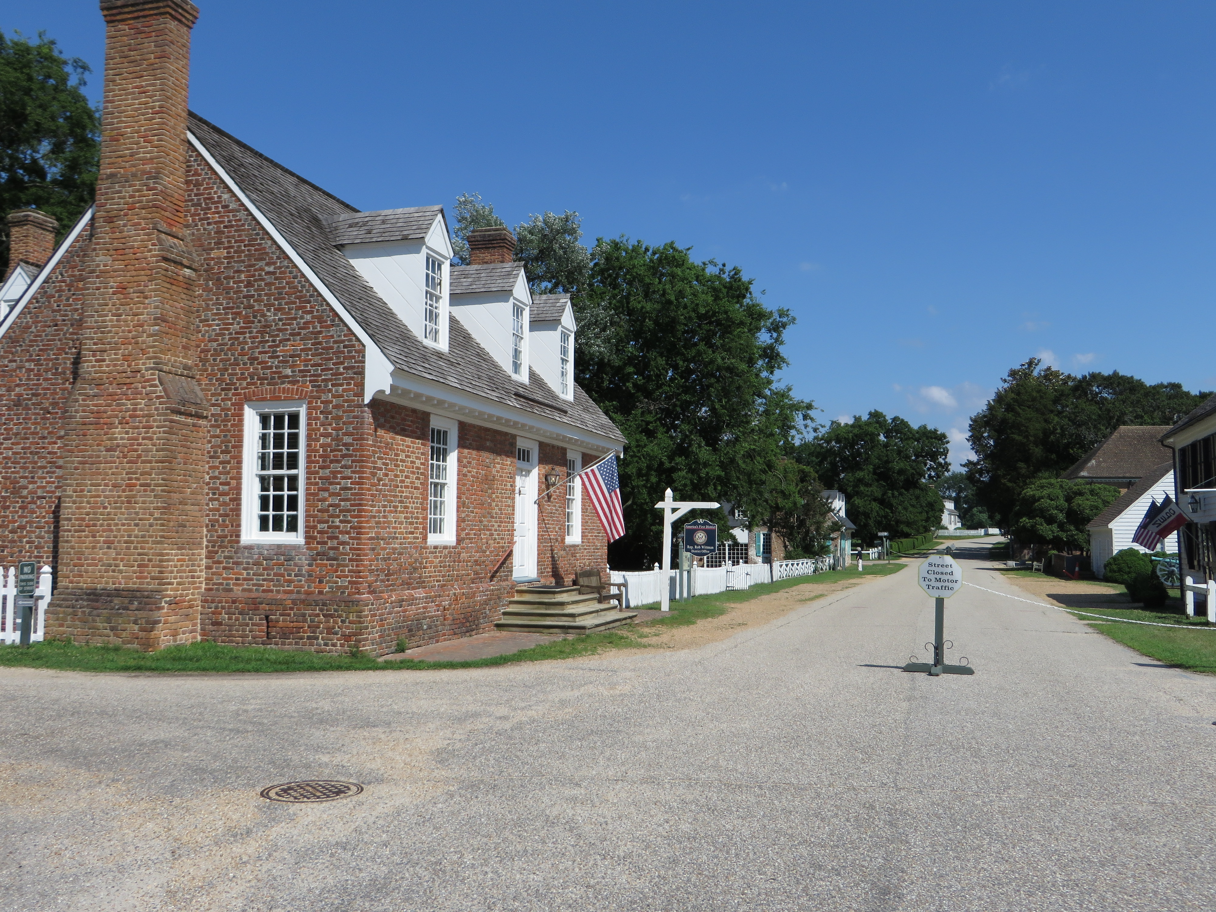
Yorktown gives the Virginia stretch of Route 17 a clear colonial-history and York River anchor. It is most useful when the road needs more than a Hampton Roads transfer and the traveler wants the Tidewater history context to become visible.
Use Yorktown between Chesapeake and Fredericksburg as a deliberate history stop, river-context pause, or Virginia-side reset before the route continues through the Tidewater and Middle Peninsula sequence.
Why Yorktown matters on Route 17
Route role
Yorktown is the history anchor near the York River crossing. It helps the Virginia side of the road feel like Tidewater history and river geography instead of only suburban approach roads and bridge decisions.
Best use
Use Yorktown as a chosen stop when the Virginia stretch needs a meaningful pause. It works best when paired with enough time to absorb the history context before continuing toward Gloucester or back into Hampton Roads.
What kind of stop Yorktown is
Best as
A deliberate York River and Revolutionary-history stop where Route 17 should slow down enough to feel historic instead of merely connective.
Works as
A half-day pause, a river-context anchor, or the place that turns the Virginia chapter into a chosen stop rather than a rushed continuation.
Weak as
A generic Williamsburg-area pass-through. Yorktown matters because it has its own history and route job.
Pairs with
Chesapeake for the gateway move, Fredericksburg for the next major reset, and Virginia when the whole chapter needs to stay in view.
How this stop helps the drive
Northbound
- Chesapeake and Hampton Roads transition: Yorktown is the history stop that gives the larger Tidewater approach a clear shape.
- Selected history pause: it is the place to stop on purpose, not the place to rush through because the map says you can.
- Gloucester and the Middle Peninsula: those are the connective next steps that keep the route continuous toward the inland chapter.
- Tappahannock and the Rappahannock context: Yorktown helps the river sequence stay legible before Fredericksburg becomes the next major stop.
Southbound
- Fredericksburg and the Virginia interior: Yorktown is the point where the route starts to feel like it is coming back down from the inland reset.
- Middle Peninsula and York River transition: it keeps the river geography visible as the drive turns back toward Tidewater.
- Chesapeake as the practical gateway: southbound, Yorktown helps the handoff back to the service-heavy Virginia edge.
- Elizabeth City and North Carolina continuation: the route keeps moving back toward the quieter Inner Banks rhythm after the Virginia chapter.
Practical route utility nearby
These nearby utility records are presented as practical planning cues from the Route 17 guide. They are not live availability, access, parking, ramp, or conditions claims. Confirm access, hours, fees, reservations, closures, and conditions with the official source before planning around any stop.
For traveler planning, read these as possible rest area, rest stop, picnic stop, public park, public parks, parks to relax, welcome center, day-use, place to stretch, stretch-your-legs, or make coffee cues only when the official rules, hours, weather, parking, and on-site conditions support that kind of pause.
Nearby utility note
York River State Park / Croaker Landing water access
This nearby utility note is a public water-access and day-use park planning cue for the Williamsburg / Yorktown edge. Treat it as cautious route-planning context, not as a claim about access, parking, ramps, or conditions.
Nearby utility note
Chippokes State Park
This nearby utility note is a campground-context planning cue for the Virginia Tidewater / James River edge. Use it as broad route-planning context, not as a claim about availability, access, parking, or conditions.
Nearby route context
Previous context
South of Yorktown, the Virginia stretch connects back toward Chesapeake and the Hampton Roads side of Virginia. That makes Yorktown feel like the chosen history pause inside the larger gateway-to-finish sequence.
Next context
North of Yorktown, Route 17 continues toward the Middle Peninsula and the inland sequence that leads to Fredericksburg. Southbound, the route works back toward Elizabeth City and the North Carolina continuation.
Route layers to use from Yorktown
Use these pages when you want Yorktown to be read as a chosen history stop, a river marker, or part of the longer Virginia finish. They keep the route decision visible before the next page takes over.
Gateway contrast
Chesapeake
Use Chesapeake when you want to compare the history stop with the practical Virginia entry point.
Next major anchor
Fredericksburg
Use Fredericksburg when Yorktown should lead into the next city-scale reset rather than linger as the only history stop.
Virginia frame
Virginia
Use the state page when Yorktown needs to sit inside the whole closing chapter instead of only the local river stop.
Virginia finish layer
Virginia Tidewater, historic corridor, and Shenandoah finish
Use the segment page when you want Yorktown to sit inside the full Tidewater-to-terminus corridor.
Southbound frame
North Carolina
Use the North Carolina page when the Yorktown stop is part of the return toward the Inner Banks and Elizabeth City.
Whole-route view
Route 17 overview
Use the overview when Yorktown should be understood as one anchor in the full Florida-to-Virginia spine.
Ask the route
Route17 AI
Use Route17 AI when you want help deciding whether Yorktown should be a short pause, a half-day history stop, or the main Virginia choice.
Best next pages
These are the pages that usually matter next. They move you from Yorktown into Fredericksburg, Chesapeake, the broader Virginia frame, or the southbound return toward North Carolina.
Next anchor
Fredericksburg
Use Fredericksburg when the route should turn from Tidewater history into the next major inland reset.
Gateway return
Chesapeake
Use Chesapeake when you want the southbound service gateway back in view.
State chapter
Virginia
Use Virginia when Yorktown should be read as part of the larger closing chapter rather than only a single stop.
Southbound continuation
Elizabeth City
Use Elizabeth City when the route should keep stepping back toward North Carolina after the Virginia history pause.