Historic waterfront anchor
Edenton at a glance
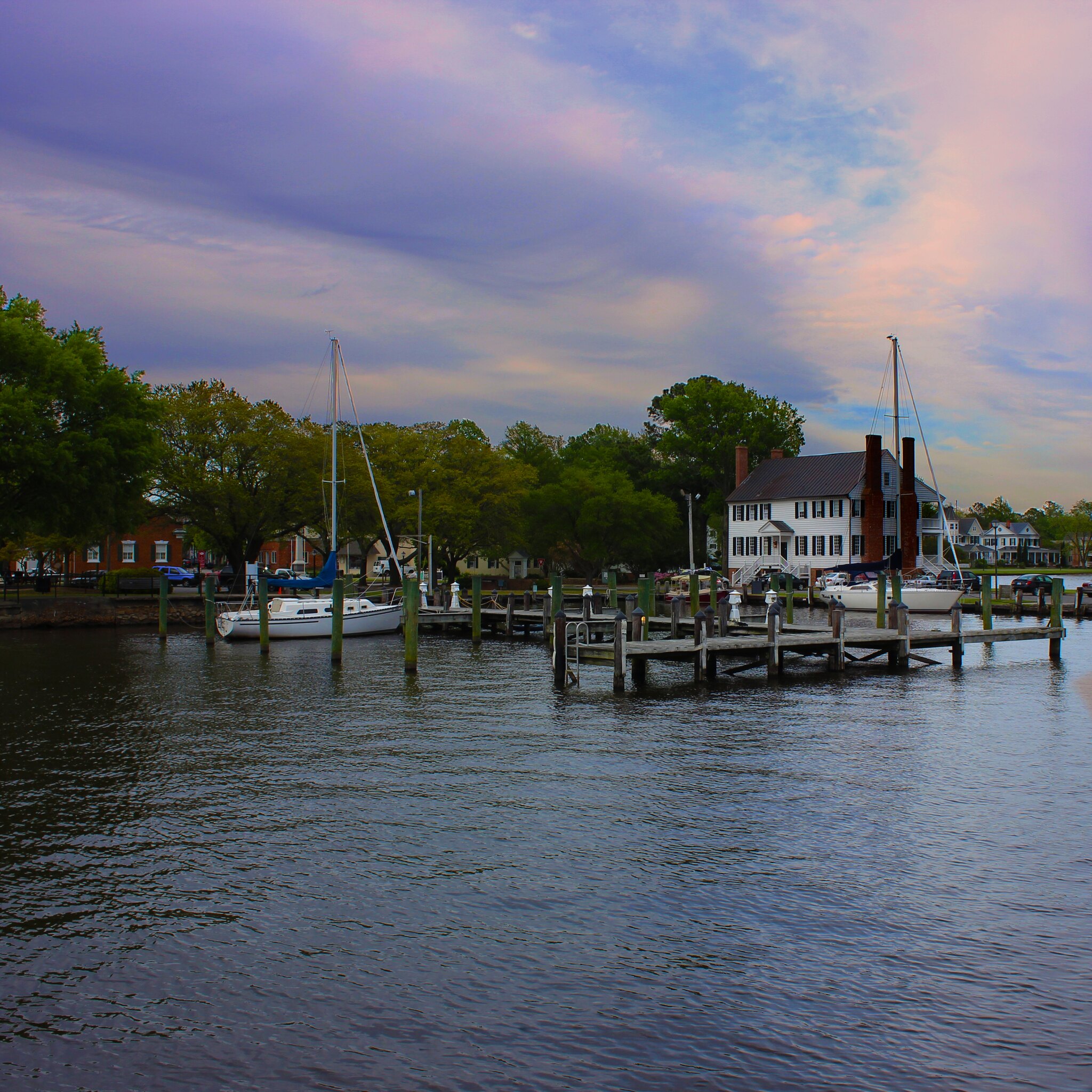
Edenton is one of the quietest and most useful Inner Banks pauses on Route 17. It brings the road back to water, history, and town-scale pacing after the route has spent time on the Wilmington and New Bern side of the chapter.
Use Edenton as a deliberate pause on the Albemarle Sound approach. It works as a waterfront walk, a history stop, a slower lunch break, or a calm overnight anchor before the route continues toward Elizabeth City and Virginia.
Why Edenton matters on Route 17
Route role
Edenton helps the northern North Carolina stretch stay readable. It gives the road a clear historic waterfront anchor before the drive moves toward the Albemarle and Dismal Swamp gateway side of the corridor.
Best use
Use Edenton when the day needs a calm town stop with enough texture to justify slowing down. It is a better anchor than a rushed pass-through when the route is being driven for place, not just mileage.
What kind of stop Edenton is
Best as
A quiet historic waterfront pause where the route can breathe before the northern handoff.
Works as
A lunch stop, a slower afternoon, or an overnight anchor when the drive should stay measured.
Weak as
A fast check-the-box stop. Edenton rewards a real pause more than a drive-by.
Pairs with
New Bern for the river-city reset, Elizabeth City for the northern gateway, and Chesapeake for the Virginia edge.
How this stop helps the drive
Best utility role
Use Edenton as a pacing decision. It can turn the Inner Banks stretch into a humane drive day by giving the route a real waterfront pause before the road continues toward Elizabeth City.
- Northbound: Edenton is the slower historic stop before the corridor gets more obviously gateway-shaped.
- Southbound: Edenton can be the first calm reset after the Virginia edge and the northern handoff.
Watch for
Keep broad corridor utility cues separate from Edenton-local claims. A nearby or edge-context planning note should support planning, not imply access or conditions. The stop should feel like route support, not a technical record.
Practical route utility nearby
These nearby utility records are presented as practical planning cues from the Route 17 guide. They are not live availability, access, parking, ramp, or conditions claims. Confirm access, hours, fees, reservations, closures, and conditions with the official source before planning around any stop.
For traveler planning, read these as possible rest area, rest stop, picnic stop, public park, public parks, parks to relax, welcome center, day-use, place to stretch, stretch-your-legs, or make coffee cues only when the official rules, hours, weather, parking, and on-site conditions support that kind of pause.
Nearby utility note
Pettigrew State Park
This nearby utility note is a campground-context planning cue for the wider Inner Banks Route 17 corridor. Treat it as a broad corridor lead, not as a claim about availability, access, parking, or conditions.
How to use this cue
Use the record only as a reminder that the Inner Banks side of the route has official-source utility context worth checking before building a longer drive day around it. Keep the cue cautious and confirm official details before relying on it.
Nearby route context
Previous context
Southwest of Edenton, the route comes through New Bern and the broader eastern North Carolina sequence. Edenton works best as the quieter middle after that river-city reset.
Next context
Northeast of Edenton, Route 17 points toward Elizabeth City, the Dismal Swamp gateway, and the Virginia transition.
What Edenton pairs with
Pair Edenton with nearby river-and-sound anchors when the North Carolina chapter should stay slow, historic, and directional.
River reset
New Bern
Use New Bern when the chapter should begin with a stronger river-city pause before settling into Edenton's quieter pace.
Open New BernNorthern gateway
Elizabeth City
Use Elizabeth City when the route should step from the historic waterfront into the final North Carolina handoff.
Open Elizabeth CityVirginia edge
Chesapeake
Use Chesapeake when Edenton needs to be read as part of the larger transition into Hampton Roads.
Open ChesapeakeRoute layers to use from Edenton
Use these links to place Edenton inside the North Carolina chapter, the Inner Banks segment, the four-anchor trip, and the Elizabeth City handoff.
State frame
North Carolina
Use the state page when Edenton needs its place inside the wider chapter.
Drive rhythm
North Carolina Cape Fear, Inner Banks, and Albemarle approach
Use the segment when the question is how the river-and-sound sequence should flow.
Trip shape
Wilmington to Elizabeth City
Use the trip page when Edenton is part of the full four-anchor northbound or southbound plan.
Northbound cue
Elizabeth City
Use Elizabeth City when Edenton is the middle stop and the next move is the Virginia handoff.
Best next pages
Continue toward Elizabeth City, step back to New Bern, or zoom out through the North Carolina chapter and four-anchor trip.
Open next
Elizabeth City
Use Elizabeth City when the route is ready for the gateway stop.
Quiet middle
New Bern
Use New Bern when you want the chapter to keep its river-city rhythm.
Chapter hub
North Carolina
Use the state page when Edenton needs its larger corridor frame.
Build the day
Wilmington to Elizabeth City
Use the trip page when Edenton sits inside the full north-south plan.